|
Contents
5. The first
projects
 |
| The first projects page (Aug
25, 99) |
| |
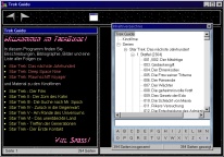 |
| The first complete "Trek
Guide", not yet in HTML, from May 1997 |
| |
 |
| The "Trek Guide" in
HTML from September 1997 |
| |
 |
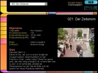
| The Subspace Manual from June
1999 looked very similiar to the present version. |
| |
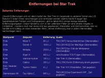 |
| "Distances of Star
Trek" - a predecessor of the Cartography |
|
Already a few days after the official
online launch of the Star Trek Dimension, it turned out that Star Trek in the internet can
be much more than "only" a LCARS database, even though this database can be
regarded as one of the most realistic and extensive information sources of this kind. In
August 1999, the mostly missed aspect of my website was a look behind the scenes of Star
Trek, which can be as fascinating as the Star Trek universe of the 23rd and 24th century
itself - what has been proven by the background material of the technical manuals and
encyclopedias. How realistic is the subspace theory of Star Trek with regard to present,
scientific hypotheses? Can the real stars of Star Trek used to create a coherent picture
of the Star Trek Galaxy? What are the inconsistencies and errors of the series and feature
films? How successful were the seasons of the different Star Trek Series according to an
evaluation of the single episodes? These and other questions wanted to be answered, and
they were answered - in the form of mostly independent, often multi-sided Star Trek
Dimension "projects", which are devoted to one specific aspect or topic of Star
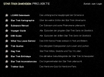
Trek in an own website area. Initially, these projects were linked to the news page, since
late August 1999 to the newly introduced projects page, the "control center" of
the Star Trek Dimension, and later also to the front page. In fact, I had created several other Star Trek projects a
long time before August 2nd, 1999, which were then gradually integrated into the Dimension
or whose basics resulted in new parts of the websites, the so-called "projects".
However, not only the already mentioned "Star Trek Guide" and its predecessors -
three encyclopedia episode guides, a first complete episode guide and the episode listings
for DS9 and Voyager, which had become a part of the Star Trek Dimension before the
reintegration of the HTML Trek Guide. belonged to these intially independent projects.
In February 1999, the Subspace Manual emerged as my second "web project", which
covered, from the first notes to the preliminary final version, the months between
November 1998 and June 1999. Moreover, these extensive description of my subspace theory
actually was my first treknology project, although in the end, it became a part of
the Dimension some time after the Star Trek Cartography was created.
The latter one was based on notes and calculations
as well, which I had gathered within several years, and a summary of the "Distances of Star Trek", which I had created in early May
1999. This discussion already consisted of the important parts - distance table, size of
Federation and Voyager's journey, even though it was only shortened version. In the end,
all texts and picture were re-created for the "Star Trek Cartography", therefore
it is the first "genuine" project of the Star Trek Dimension beside the LCARS
database. The work on the Cartography started on August 3rd, 1999, being the starting
signal for many other Star Trek Dimension projects, which were created shortly afterwards. |
6. Project development
In the meantime, there are still a
dozen other projects beside the main project of the Dimension, the LCARS database, dealing
with the Star Trek technology or the episodes, offering ressources for download or simply
promising a lot of fun. Every one of this projects tries to be unique concerning its field
- with regard to the content itself as well as its representation, i.e. its design and
layout. Of course, this takes a lot of time - for the research of the facts, to write the
texts, collect the photos or create the pictures, diagrams and logos. Moreover, since late
1999, the efforts has been doubled, because most projects are also avaiable in English
since then. But how are they created - those unique models of the planets and those
magnificent high-quality photos of the LCARS database, the 3D models of Utopia Planitia or
the Star Trek maps of the Cartography? The following pictures and descriptions will give a
short insight into the work behind the projects.
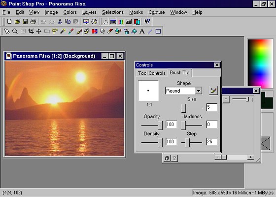
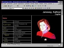
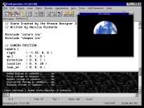
| The LCARS database of the Star Trek
Dimension stands out not from the texts, which are created (like all other projects) with
Microsoft FrontPage 98, but its multimedia-representation, i.e. the large number of
photos, LCARS diagrams and sounds. These resources were scanned from Star Trek books and
magazines, taken from the Internet or from CDs or grabbed directly from TV. The most
magnificent shots are, of course, the scans, especially if there are taken from such
high-quality illustrated books like the "Art of Star Trek". However, no matter
where the pictures were taken from, often an extensive editing is necessary, before they
can added to the database. If needful, colors and contrasts have to be increased, the
quality of the shots has to be raised, spoiling texts, logos or the entire background of
the picture has to be deleted and missing parts of the images have to be trickily
retouched. This is done with Paintshop Pro 5.0, in my view the image editing program with
the most innovative functions. Particularly the complex masking- and layer features
facilitate the creation of the photos, diagrams and logos of the Star Trek Dimension
considerably. |
 |
| Usually, many steps are
necessary to turn the scanned photo into the finally used database picture. |
 |
 |
 |
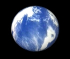
| Beside the normal image editing,
increasingly three-dimensional pictures are important for the Star Trek Dimension, which
are modelled nowadays with the professional program Soft F/X. However, from the very
beginning, rendered models of planets were an integral part of the LCARS database, which
are still created with the freeware program POVRAY 3.0. |
 |
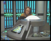
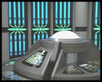
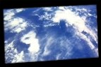
| From the screenshot
from [DS9] Time's Orphan to the final model of Kolana - an example of "planetary
rendering". |
 |
 |
 |
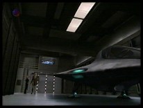
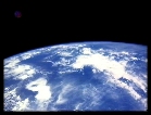
| Isn't there a photo
avaiable for scanning, the episode or movie itself is used as a source for the picture.
Because in contrast to the photos, which are specially taken by photographers during the
production, the pictures grabbed from TV are often insufficient concerning quality
and scene arrangement, a sophisticated post-editing is necessary, usually including edge
enhancement, the deletion of the TV channel logo, saturation increasing, color noise
reduction and sometimes the reconstruction of missing image parts. |
|
|
| |
|
|
|
|
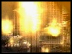
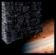
Sometimes, creativity surpasses
reality, resulting in completely new pictures for scenes which were mtnioned, but never
shown, like the Third World War, the attack of the Jem'Hadar on Betazed or the Borg cube
passing Jupiter. |
| Other pictures I have created, but they
did never became a part of the LCARS database, like the shown, LCARS-like score for
"Row, row, row your boat", which originally should be added to the file
"Human music". One reason for why it wasn't added in the end is that I
thought such a notation wouldn't be contemporary anymore in the 24th century, however,
similiar scores have been shown in Star Trek: Voyager in the meantime. |
 |
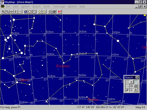
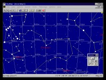
| For the second Star Trek Dimension
project, the Star Trek cartography, not only the sources already used for the database
(facts from CDs, books; pictures from CDs, books and TV) were included, but also strictly
scientific data. Moreover, the usage of real astronomic methods and algorithms
necessitated also the deployment of special programs like Skymap 3.0, a program which
displays the starry sky and offers up-to-date information on most of the real stars of
Star Trek. |
 |
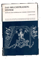 |
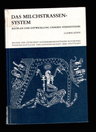
In fact, most of the
astronomic knowledge and data the Star Trek Cartography is based on does not come from
programs or the internet (even though the highly precise HIPPARCOS coordinates and
parallaxes of the stars are avaiable for free only in the World Wide Web), but from nearly
two dozen books on classic astronomy, stellar physics, cosmology and astrobiology, for
which the shown treatise upon the Milky Way is only an example. |
Nie verwendetes Logo für die Star Trek Kartographie von Anfang 2000 |
|
|
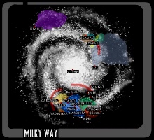
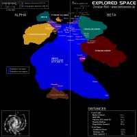
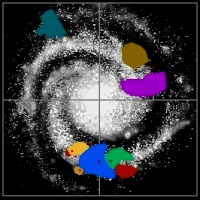
| One of the cornerstones of the
Cartography project and surely its most popular part is the Galactic Atlas with its
colorful, poster-sized map of local space. This map contains, on the one hand, the
scientifically correct positions of 35 real Star Trek stars, but on the other hand, also
the approximate positions of some dozens of fictitious planets, star bases, deep space
stations and nebulas, which were all derived from the distances and descriptions given in
the episodes, including the possible border lines between the different empires and
alliances. However, it was a long way from my first Star Trek map, which was created still
ebfore the online launch of the site in mid 1999 and which was based on the rough, inexact
overview maps from the official publications, to the presently still up-to-date version
4.0 of the map of local space. |
 |
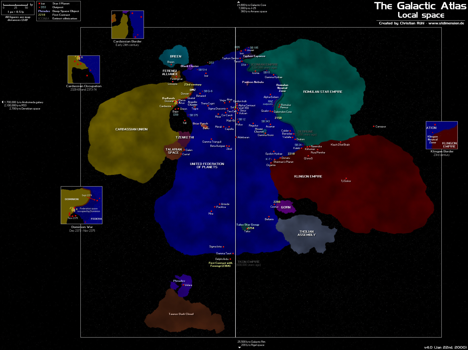
| The project "Utopia
Planitia", which gives a number of "conjectural classes" (those starship
classes, which are mentioned in the encyclopedia, but there never shown on screen) a
non-canon appearance created by me, an extensive specification and an as well fictitious
background story, was a result of my progress concerning the rendering of
three-dimensional starships, which I also owe my new "tool", the 3D modeler,
renderer and animator Soft F/X 4.0. |
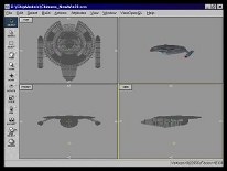 |
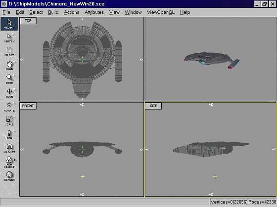
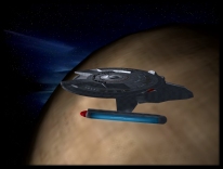
| The models of most of the created
starship classes only exist as rough study models which hasn't been improved and finalized
- except the Chimera class, which has been continued for the ASDB internet project. In the
meantime, there exists a highly detailed and realistic 3D model for this class, the 19th
version, which will be presented soon in the Utopa Planitia project with fantastic
pictures. A short insight gives the photo in the margin. |
 |
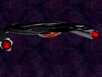
The first mesh from October 1999, which was
still called "Challenger class" at that time. |
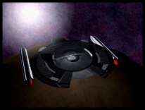
The version published in the project isn't very
detailled, however, it already has the final proportions of the vessel.
|
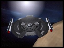
An improved version from March 1999, which
has an indiviual texture for the saucer section for the first time.
|
How the three presented projects show,
every part of the Star Trek Dimension, every text and every picture is the result of a
longer development process. Vice versa, not every idea and every sketch led to a
published final version. Some pictures were not integrated into the LCARS database, some
logos were dropped in favor of other ones, and even some complete projects were abanoned a
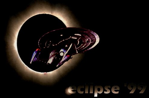
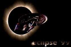
long time before their completion. The reasons are various, but for example, in case of
the "eclipse 99" report, the basic idea finally appeared to be nonsense. In
fact, the image shown above is the only existing part of this project, a direct product of
the hysteria because of the total eclipse in Central Europe in August 1999. In the end,
it's a cool pic, but nevertheless it was never intended to be the logo for a entire
project, and before I had entered the first letter, the whole matter was already
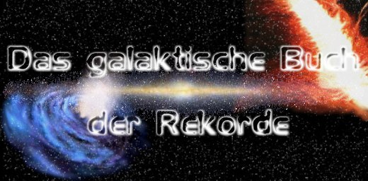
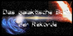
forgotten. The "Galactic Book of Records", on the other hand, was a different
issue. There was a concrete idea for this projekt, and the immediate work had been
started, when the project was abandoned. Firstly because there simply weren't enough
"galactic records", but mainly because the project seemed to be too
"mainstream-orientated" and superficial and would neither have had the necessary
horoughness nor a definite outcome.
|
 |
|
|